sent in by Donna Talarski
Link:
A Snapshot of Coastal History
The Oregon State Archives has put together a nice web site entitled "1940 Oregon Coast Tour". We've linked to the chapters of their site below to give you a glimpse into a little history of the Oregon Coast.
This section of U.S. 101 even more closely hugs the sea than does the section to the north. Villages are fewer because the Coast Range here presses closer to the sea.

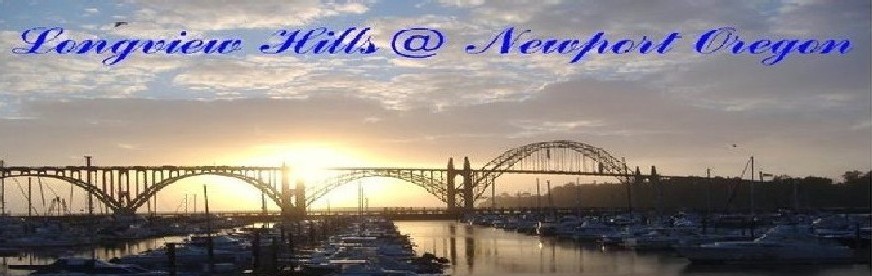
At the southern edge of NEWPORT, 0 m., the highway passes through a landscaped park, then crosses the YAQUINA BAY BRIDGE, 1 m., a graceful cantilever structure, completed in 1936. The bridge deck, rising to 138 feet above the channel water, is high enough to permit the passage of ocean-going craft. Yaquina Bay, cupped by green hills is L., and the bar and jetties, long fingers extending seaward from the promontories, are R. The north shore rises sheer 150 feet, but the south shore is low, with partly wooded dunes.
In the 1880s a townsite was platted at SEAL ROCKS, 10.5 m. A large hotel was built, but development lagged. Today the village consists of a store, a post office, and several cabin camps. Sea lions still bask on the rocks offshore.
No comments:
Post a Comment