Asteroid May Hit Mars Next Month: "Scientists tracking the asteroid, currently halfway between Earth and Mars, initially put the odds of impact at 1 in 350 but increased the chances this week.
Scientists expect the odds to diminish again early next month after getting new observations of the asteroid's orbit, Chesley said.
'We know that it's going to fly by Mars and most likely going to miss, but there's a possibility of an impact,' he said."

Friday, December 21, 2007


Ron & Jacky Christmas on the road...
Southbound on 101
During our trip Southbound on 101...
Gas in OR $ 2.89
Gas in CA $3.39....
Babe the Blue Ox has no head???
Coupon in the travel book at the rest stop yielded one for $55.95 at Howard Johnson's Hotel in Arcata.....
The mud slide area south of Garberville... The one that slides every year... They are building a bridge bypass around it... Has two gigantic supports in various stages of construction.. Iron worker working several 100ft in the air worth a stop and watch.
Some elk munching grass near the Prairie Creek viewing area....
More Elk just south of Layton....
New HAM radio had me in contact with other HAMS all along the route using pre-programed repeaters.
Traffic very light...
Today at Lori's ... work setting up for Christmas....
Southbound on 101
During our trip Southbound on 101...
Gas in OR $ 2.89
Gas in CA $3.39....
Babe the Blue Ox has no head???
Coupon in the travel book at the rest stop yielded one for $55.95 at Howard Johnson's Hotel in Arcata.....
The mud slide area south of Garberville... The one that slides every year... They are building a bridge bypass around it... Has two gigantic supports in various stages of construction.. Iron worker working several 100ft in the air worth a stop and watch.
Some elk munching grass near the Prairie Creek viewing area....
More Elk just south of Layton....
New HAM radio had me in contact with other HAMS all along the route using pre-programed repeaters.
Traffic very light...
Today at Lori's ... work setting up for Christmas....
Wednesday, December 19, 2007
CurryPilot.com
CurryPilot.com: "A tsunami warning for the coast of Alaska, and a tsunami advisory for the coastal areas of California, Oregon, Washington and British Columbia, Canada, were cancelled at 2:07 a.m. today (Wednesday) after alarms were sounded throughout Curry County and the West Coast in the early morning.
The National Warning System (NAWAS) cancelled both the warning and advisory after no destructive tsunami was recorded, and 'no tsunami danger exists for Alaska, British Columbia, Washington, Oregon or California.'"
The National Warning System (NAWAS) cancelled both the warning and advisory after no destructive tsunami was recorded, and 'no tsunami danger exists for Alaska, British Columbia, Washington, Oregon or California.'"
Newport News-Times: CERT members ready for all weather conditions

Newport News-Times: CERT members ready for all weather conditions: "At a recent meeting of Central Coast CERT (Community Emergency Response Team), the group received new ANSI (Federal Safety Standard) approved jackets. These jackets provide vital protection for CERT members, not only with respect to inclement weather, but also for maximum visibility and easy identification in poor conditions. The purchase of these jackets was made possible by a grant from the Confederated Tribes of Siletz Indians. Earlier this year, the tribe awarded CERT with a grant of $2,500, which enabled the group to purchase 53 jackets."
Tuesday, December 18, 2007
How It All Ends
Here is an Oregonian that might make a difference. Start watching I think you will be mesmerized.... RT
NewsGator Online
NewsGator Online: "'Talent hits a target no one else can hit; Genius hits a target no one else can see.'
'Talent hits a target no one else can hit; Genius hits a target no one else can see.'
[Add to Clippings] [Forward post via email] [Instant Message this post to a friend.]"
'Talent hits a target no one else can hit; Genius hits a target no one else can see.'
[Add to Clippings] [Forward post via email] [Instant Message this post to a friend.]"
Monday, December 17, 2007
NewsGator Online
NewsGator Online: "Albert Einstein
'My religion consists of a humble admiration of the illimitable superior spirit who reveals himself in the slight details we are able to perceive with our frail and feeble mind.'"
'My religion consists of a humble admiration of the illimitable superior spirit who reveals himself in the slight details we are able to perceive with our frail and feeble mind.'"
NewsGator Online
NewsGator Online: "'Drive-in banks were established so most of the cars today could see their real owners.'"
POLITICS !!
by ron thomas (editor)
We stay neutral in politics here on the website because politics evokes a lot of animosity these days but with the coming elections I have been searching for something that all points of view might like to see. What I have found is brand new and resembles a racing form. It is a new item from Yahoo that shows all the up to the minute polls on all the candidates and much more. It also has a tab to the states and the data on all the candidate races.
I would be interested in whether you would like to see a link to this site installed on our page? Not many folks comment anymore but you do answer polls so we will put a poll question up and see what your response is.
Here is the link to Yahoo's new political DASHBOARD..
YAHOO DASHBOARD CLICK HERE
by ron thomas (editor)
We stay neutral in politics here on the website because politics evokes a lot of animosity these days but with the coming elections I have been searching for something that all points of view might like to see. What I have found is brand new and resembles a racing form. It is a new item from Yahoo that shows all the up to the minute polls on all the candidates and much more. It also has a tab to the states and the data on all the candidate races.
I would be interested in whether you would like to see a link to this site installed on our page? Not many folks comment anymore but you do answer polls so we will put a poll question up and see what your response is.
Here is the link to Yahoo's new political DASHBOARD..
YAHOO DASHBOARD CLICK HERE
Sunday, December 16, 2007
NewsGator Online
NewsGator Online: "'Imagine if every Thursday your shoes exploded if you tied them the usual way. This happens to us all the time with computers, and nobody thinks of complaining.'"
NewsGator Online
NewsGator Online: "'The perfect bureaucrat everywhere is the man who manages to make no decisions and escape all responsibility.'"
Business - How a bag can help the environment - INQUIRER.net
Ron says.. This is an opportunity to help save the environment by just changing the habit of using plastic bags... They used to ask paper or plastic at Freddy's but I don't hear that anymore do you? The article says they sold reusable cloth bags to their customers and helped save a tree or two also. Little things can make a big impact.... What do you think?
Business - How a bag can help the environment - INQUIRER.net: "RSI says it takes “approximately 200 years for a plastic bag to dissolve, and it would have taken 540 million years for these bags to disintegrate.”
The Reusable Bag Program benefited the firm’s business and the environment. RSI saved a few million by cutting down on its plastic bag purchase, while it earned a few million from the sale of its tote bags, which go for P100 each."
Business - How a bag can help the environment - INQUIRER.net: "RSI says it takes “approximately 200 years for a plastic bag to dissolve, and it would have taken 540 million years for these bags to disintegrate.”
The Reusable Bag Program benefited the firm’s business and the environment. RSI saved a few million by cutting down on its plastic bag purchase, while it earned a few million from the sale of its tote bags, which go for P100 each."
Saturday, December 15, 2007
NewsGator Online
NewsGator Online: "Thomas Jefferson
12/14/2007 5:00:00 PM [rss@quotationspage.com (Quotes of the Day)]
'I believe that banking institutions are more dangerous to our liberties than standing armies. '
12/14/2007 5:00:00 PM [rss@quotationspage.com (Quotes of the Day)]
'I believe that banking institutions are more dangerous to our liberties than standing armies. '
BBC NEWS | Science/Nature | Ice Age blast 'ravaged America'

BBC NEWS | Science/Nature | Ice Age blast 'ravaged America': "A controversial new idea suggests that a large space rock exploded over North America 13,000 years ago.
The blast may have wiped out one of America's first Stone Age cultures as well as the continent's big mammals such as the mammoth and the mastodon."
*
Friday, December 14, 2007
Batten down the hatches thar she blows again!!
HIGH WIND WATCH IN EFFECT FROM SUNDAY MORNING
THROUGH SUNDAY AFTERNOON FOR THE SOUTH WASHINGTON COAST AND THE NORTH AND CENTRAL OREGON COAST
Urgent - Weather Message National Weather Service Portland OR 1207 PM PST Fri Dec 14 2007
North Oregon Coast-Central Oregon Coast-South Washington Coast- Including The Cities Of...Astoria...Cannon Beach...Tillamook... Lincoln City...Newport...Florence...Raymond...Long Beach... Cathlamet 1207 PM PST Fri Dec 14 2007
...High Wind Watch In Effect From Sunday Morning Through Sunday Afternoon For The South Washington Coast And The North And Central Oregon Coast...
The National Weather Service In Portland Has Issued A High Wind Watch...Which Is In Effect From Sunday Morning Through Sunday Afternoon.
A Series Of Frontal Systems Will Move Off The Pacific Ocean And Into The Pacific Northwest To Bring Very Gusty Winds To The South Washington Coast And The North And Central Oregon Coast. These Fronts Will Also Bring Gusty Winds To The North And Central Oregon Coast Range.
The First Front Will Come Inland Tonight With South Winds Expected To Increase To 30 Mph With Gusts 45 Mph At The North Oregon And South Washington Coast During The Evening And To 25 Mph With Gusts 35 To 45 Mph On The Ridges Of The North And Central Oregon Coast Range.
Be Aware That Trees May Weakened...And More Prone To Falling...By Previous Wind And Rain Storms In These Areas.
A High Wind Watch Is Now In Effect For The South Washington Coast And The North Oregon Coast For South Winds 35 Mph With Gusts 60 To 65 Mph Sunday As The Second...Stronger Front Approaches. These Winds Will Be Strongest Near The Beaches But May Also Affect The Coastal Communities. As That Front Moves Inland Also Expect South Winds 30 Mph With Gusts 40 To 50 Mph In The Higher Elevations Of The North And Central Oregon Coast Range. This Front Could Either Weaken Or Strengthen...And The High Wind Watch May Be Upgraded To A Warning Or Canceled As The Event Becomes More Clearly Defined. Stay Abreast Of Later Bulletins Concerning This Developing Weather Pattern.
A High Wind Watch Means There Is The Potential For A Hazardous High Wind Event. Sustained Winds Of At Least 40 Mph...Or Gusts Of 58 Mph Or Stronger May Occur. Continue To Monitor The Latest Forecasts.
HIGH WIND WATCH IN EFFECT FROM SUNDAY MORNING
THROUGH SUNDAY AFTERNOON FOR THE SOUTH WASHINGTON COAST AND THE NORTH AND CENTRAL OREGON COAST
Urgent - Weather Message National Weather Service Portland OR 1207 PM PST Fri Dec 14 2007
North Oregon Coast-Central Oregon Coast-South Washington Coast- Including The Cities Of...Astoria...Cannon Beach...Tillamook... Lincoln City...Newport...Florence...Raymond...Long Beach... Cathlamet 1207 PM PST Fri Dec 14 2007
...High Wind Watch In Effect From Sunday Morning Through Sunday Afternoon For The South Washington Coast And The North And Central Oregon Coast...
The National Weather Service In Portland Has Issued A High Wind Watch...Which Is In Effect From Sunday Morning Through Sunday Afternoon.
A Series Of Frontal Systems Will Move Off The Pacific Ocean And Into The Pacific Northwest To Bring Very Gusty Winds To The South Washington Coast And The North And Central Oregon Coast. These Fronts Will Also Bring Gusty Winds To The North And Central Oregon Coast Range.
The First Front Will Come Inland Tonight With South Winds Expected To Increase To 30 Mph With Gusts 45 Mph At The North Oregon And South Washington Coast During The Evening And To 25 Mph With Gusts 35 To 45 Mph On The Ridges Of The North And Central Oregon Coast Range.
Be Aware That Trees May Weakened...And More Prone To Falling...By Previous Wind And Rain Storms In These Areas.
A High Wind Watch Is Now In Effect For The South Washington Coast And The North Oregon Coast For South Winds 35 Mph With Gusts 60 To 65 Mph Sunday As The Second...Stronger Front Approaches. These Winds Will Be Strongest Near The Beaches But May Also Affect The Coastal Communities. As That Front Moves Inland Also Expect South Winds 30 Mph With Gusts 40 To 50 Mph In The Higher Elevations Of The North And Central Oregon Coast Range. This Front Could Either Weaken Or Strengthen...And The High Wind Watch May Be Upgraded To A Warning Or Canceled As The Event Becomes More Clearly Defined. Stay Abreast Of Later Bulletins Concerning This Developing Weather Pattern.
A High Wind Watch Means There Is The Potential For A Hazardous High Wind Event. Sustained Winds Of At Least 40 Mph...Or Gusts Of 58 Mph Or Stronger May Occur. Continue To Monitor The Latest Forecasts.
Fertilized Microbes Make Natural Gas Fast, Study Says
Fertilized Microbes Make Natural Gas Fast, Study Says: "A vast new energy supply could be generated simply by feeding fertilizer to deep-dwelling microbes that create the key ingredient of natural gas as they live off harder-to-tap deposits in older oil fields, new research suggests.
Canadian and English researchers were able to convert heavy oil into usable methane in small glass tubes in a mere two years of lab research—instead of the tens of thousands of years the process can take on its own."
Canadian and English researchers were able to convert heavy oil into usable methane in small glass tubes in a mere two years of lab research—instead of the tens of thousands of years the process can take on its own."
Thursday, December 13, 2007
FREE CEDAR BOUGHS
Make your home an aromatic treat for your visitors this holiday season and take some Cedar boughs home. Cut them up and spread them around your home... The smell of Christmas. There are a number left over from the Christmas arrangement class at the clubhouse in the back end of the little red pick up truck on Windmill dr.. Ron & Jacky's home. Take what you want.. There is nothing like fresh cut cedar.
We thank the Dudley's and the Fishing Club for getting them for the park.
Make your home an aromatic treat for your visitors this holiday season and take some Cedar boughs home. Cut them up and spread them around your home... The smell of Christmas. There are a number left over from the Christmas arrangement class at the clubhouse in the back end of the little red pick up truck on Windmill dr.. Ron & Jacky's home. Take what you want.. There is nothing like fresh cut cedar.
We thank the Dudley's and the Fishing Club for getting them for the park.
Wednesday, December 12, 2007
"Year's Best" Meteor Shower to Peak December 13-14

"Year's Best" Meteor Shower to Peak December 13-14: "The Geminid meteor shower—considered by many to be the most active annual sky show—is going to be especially spectacular this year, astronomers predict. The show gets its name from the constellation Gemini, because the meteors appear to stream from near the constellation's bright star Castor. Geminid meteor picture Enlarge Photo _ Printer Friendly Email to a Friend RELATED * Images: Asteroids and Comets * Rare Aurigid Meteor Shower to Appear September 1 (August 30, 2007) * Leonid Meteor Shower Peaks November 17-18 (November 16, 2007) Unlike last year, the Geminids will be falling against a dark, moonless night. The last time the sky was this dark during the shower was in 1996, when observers saw up to 110 meteors an hour. Experts say the rate will be at least that high this year, with peak viewing on December 13 and 14."
Energy source of Northern Lights found - USATODAY.com

Energy source of Northern Lights found - USATODAY.com: "Scientists think they have discovered the energy source of the spectacular color displays seen in the northern lights. New data from NASA's Themis mission, a quintet of satellites launched this winter, found the energy comes from a stream of charged particles from the sun flowing like a current through twisted bundles of magnetic fields connecting Earth's upper atmosphere to the sun."
NewsGator Online
NewsGator Online: "'To do just the opposite is also a form of imitation.' 'To do just the opposite is also a form of imitation.' [Add to Clippings] [Forward post via email] [Instant Message this post to a friend.] "
NewsGator Online
NewsGator Online: "'Seeing ourselves as others see us would probably confirm our worst suspicions about them.'"
NewsGator Online
NewsGator Online: "'A synonym is a word you use when you can't spell the word you first thought of.'"
BBC NEWS | Science/Nature | Great beasts peppered from space

BBC NEWS | Science/Nature | Great beasts peppered from space: "Startling evidence has been found which shows mammoth and other great beasts from the last ice age were blasted with material that came from space. Eight tusks dating to some 35,000 years ago all show signs of having being peppered with meteorite fragments."
*
KTVZ.com Central Oregons News, Weather and Sports Leader - Coast Guard rescues three from Oregon fishing ship afire
KTVZ.com Central Oregons News, Weather and Sports Leader - Coast Guard rescues three from Oregon fishing ship afire: "TILLAMOOK, Ore. (AP) - The Coast Guard rescued three men today from a burning commercial fishing ship off the Oregon coast at Tillamook. The fire in the engine room of the 64-foot vessel sent smoke into the wheel house, making it impossible to call for help on the ship's radio. The crew had to use a cell phone to call for help before putting on survival suits and preparing to abandon ship."
Tuesday, December 11, 2007

Sunday, December 09, 2007
R U A SCANNER DOG?
Scanner dogs are people who listen to radio scanners to hear what's going on in the community. They know what the police are doing and the sheriff, fire department, ambulance, rescue teams, PUD, Coast Guard and all manner of agencies.
Not only is it interesting but can be very helpful during power outages and severe weather.. Keeps you abreast of what's going on.
One of the things that all these agencies use to identify where they are is to give their position reports as next to such and such mileage marker. Now, thanks to Dan Wilson for getting us a copy of those locations and to Barb Dudley for retyping it as a google document and publishing it to the internet we have a link we can use to make a copy of those locations any time we want.
Look on the left just above the CERT Logo and you will find our new Scanner Dog link...
Our Thanks to Dan and Barb.
Scanner dogs are people who listen to radio scanners to hear what's going on in the community. They know what the police are doing and the sheriff, fire department, ambulance, rescue teams, PUD, Coast Guard and all manner of agencies.
Not only is it interesting but can be very helpful during power outages and severe weather.. Keeps you abreast of what's going on.
One of the things that all these agencies use to identify where they are is to give their position reports as next to such and such mileage marker. Now, thanks to Dan Wilson for getting us a copy of those locations and to Barb Dudley for retyping it as a google document and publishing it to the internet we have a link we can use to make a copy of those locations any time we want.
Look on the left just above the CERT Logo and you will find our new Scanner Dog link...
Our Thanks to Dan and Barb.
Amateur radio operators step up when needed to keep county in touch with the world
Amateur radio operators step up when needed to keep county in touch with the world: "When twin storms hammered the coast Sunday through Monday with hurricane-force winds, snapping tree limbs like twigs and cutting power to thousands in Clatsop County, amateur radio operators didn't just bolster efforts at the county Emergency Operations Center. They were the heart of the response."
Efforts to Harvest Ocean’s Energy Open New Debate Front - New York Times

Efforts to Harvest Ocean’s Energy Open New Debate Front - New York Times: "NEWPORT, Ore. — Chris Martinson and his fellow fishermen catch crab and shrimp in the same big swell that one day could generate an important part of the Northwest’s energy supply. Wave farms, harvested with high-tech buoys that are being tested here on the Oregon coast, would strain clean, renewable power from the surging sea."
*
China Link Suspected in Lab Hacking - New York Times
Editor: This story is about an attack on our defense laboratories by computer hackers... The key thing for you to note is, "they opened the attachments". Don't open attachments from sources you don't know about...simple as that.
China Link Suspected in Lab Hacking - New York Times: "he wrote in an e-mail message sent to employees on Monday. “At present we believe that about 11 staff opened the attachments, which enabled the hackers to infiltrate the system and remove data.”"
China Link Suspected in Lab Hacking - New York Times: "he wrote in an e-mail message sent to employees on Monday. “At present we believe that about 11 staff opened the attachments, which enabled the hackers to infiltrate the system and remove data.”"
NewsGator Online
NewsGator Online: "'Everything is funny as long as it is happening to Somebody Else.'"
Food: Fifteen Foods that Burn More Calories than They Contain
Food: Fifteen Foods that Burn More Calories than They Contain: "We need to scarf down plenty of calories in a day, but if you've got a nasty snack habit that's tipping the scales to heavy, weblog Bootstrapper's list of 15 foods that burn more calories than they contain might be the perfect addition to your grocery list. Called negative calorie foods, the following 15 treats actual burn more calories in their digestion than they offer, so you can fulfill your snack craving without the guilt of a bag of potato chips. From apples to zucchini, these foods make the perfect snacks. Hit the jump for the full list."
Saturday, December 08, 2007
News - StatesmanJournal.com

News - StatesmanJournal.com: "A single candle taper burns on a wooden end table -- but then it topples. Instantly a Christmas tree catches fire, and flames devour wrapped presents near its base. The fire spreads, engulfing the living room and its furniture. Curtains burn away, and the home's picture window shatters in the heat. Odds are good something like this will happen somewhere this holiday season -- and that's precisely why Fire Marshal Joel Stein of Keizer Fire District staged the fire for a recent training exercise and public safety campaign."
Wild Stories Emerge from Oregon Coast Tempest
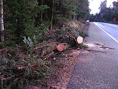
Wild Stories Emerge from Oregon Coast Tempest: "Oregon Coast) – One woman nearly lost her dog to a gust. Another fell through a second story floor and broke her ribs. Two people died in the Nehalem area. Trees smashed the homes and vehicles of residents. Tourists were stranded. Entire churches or piers were ripped away. Highways were blocked by thick masses of debris. And then there were the days of darkness and no showering that followed. The storm and it’s aftermath have been quite an adventure."
*
Spirits Good on Oregon Coast Despite No Power
Spirits Good on Oregon Coast Despite No Power: "Seaside came back on the grid around 3 p.m. Friday. 114 hours without power – since Sunday night – said Seaside Aquarium manager Keith Chandler. Manzanita came back online Thursday night. Lincoln City was fully restored by Thursday as well, and Astoria is almost completely back from the black. Cannon Beach and Arch Cape are still using generator power, while most of Lincoln County south of Lincoln City has been up since early this week or never lost power in the first place. Manzanita at dusk on Thursday: a city of lights on the sea, created by gobs of crabbers Now, the coastal highways and Highway 101 are a living testaments to the devastation, with huge chunks of forests simply blown over – trees that were snapped by the forces of the wind. Along the sides of the highways sit heaps of broken trees, lumped together in piles after they were moved from the roadways and then chopped into bits by chainsaws."
NewsGator Online
NewsGator Online: "'People demand freedom of speech as a compensation for the freedom of thought which they seldom use.'"
NewsGator Online
NewsGator Online: "'By the time a man realizes that maybe his father was right, he usually has a son who thinks he's wrong.'"
HEAT))))))
If the clubhouse were to have an efficient wood pellet burning stove..... If there were an extended power outage we would have a warm place to go...uhhmmmm. Maybe such a stove would cut the electrical heating bill so much that it would be an attractive addition for Brian Fitterer (park managing partner) to consider?
Maybe when the park bought pellets in large quantities they would get a price break that they could pass on to those that have stoves by selling to them. A combining of needs to lower the price for all.
Maybe if we were all to work together we could get high speed broadband internet to one central place in the park and rebroadcast it for everyones use through out the park.. and greatly reduce the cost.
Getting the park to throw in with us is not that hard. Having dealt with Brian before I have found that if you want something from him you have to show how the cost of the item you are asking him to buy will not only benefit us but will reduce his bottom line expense. When you do that he seems to be perfectly amenable to helping.
Do you have ideas that will benefit the park and the residents? Write them in the comments ... Let's see if we don't get some really good ones to work on. Remember, the idea has to help us or improve conditions and help the park's bottom line.
If the clubhouse were to have an efficient wood pellet burning stove..... If there were an extended power outage we would have a warm place to go...uhhmmmm. Maybe such a stove would cut the electrical heating bill so much that it would be an attractive addition for Brian Fitterer (park managing partner) to consider?
Maybe when the park bought pellets in large quantities they would get a price break that they could pass on to those that have stoves by selling to them. A combining of needs to lower the price for all.
Maybe if we were all to work together we could get high speed broadband internet to one central place in the park and rebroadcast it for everyones use through out the park.. and greatly reduce the cost.
Getting the park to throw in with us is not that hard. Having dealt with Brian before I have found that if you want something from him you have to show how the cost of the item you are asking him to buy will not only benefit us but will reduce his bottom line expense. When you do that he seems to be perfectly amenable to helping.
Do you have ideas that will benefit the park and the residents? Write them in the comments ... Let's see if we don't get some really good ones to work on. Remember, the idea has to help us or improve conditions and help the park's bottom line.
Ham radio operators add to relief effort in storm-battered Oregon
Ham radio operators add to relief effort in storm-battered Oregon: "In Oregon, about 200 volunteer ham radio operators have donated their time since last Sunday night to provide needed communications since the storms struck, said Vince Vanderhyde, emergency coordinator for the amateur radio volunteers who assist the Oregon Emergency Management Agency (OEM). 'I spoke to a woman who's been operating her radio in [the city of] Vernonia for 20 hours straight,' Vanderhyde said. 'Another guy volunteered to help communicate, then he said he was exhausted and was heading home to clean up his own house, which had been flooded with floodwaters. I have to tell you, it's the most dedicated bunch of citizen volunteers that you can imagine.'"
Campground obliterated as slide triggers 'tsunami'
Campground obliterated as slide triggers 'tsunami': "Penner said the incident likely occurred during Monday's rain storm when part of a nearby mountain slid into the western end of the lake. Since then, about two hectares of debris has been pushed to the eastern end of the lake, where it meets the Chehalis River, a tributary of the Harrison River, he said. The water appeared to have rocked back and forth on either side of the lake, pulling trees and brush into the lake, he said. 'A big chunk of a side of a mountain let go,' Penner said, describing the devastation he witnessed. 'The wall of water that was pushed up out of the lake was at least 30 to 40 feet high as it came ashore at the west end of the lake.'"
Friday, December 07, 2007
WOW!
Larry Henson just sent us a link on a new NOAA weather satellite feed. We will be adding it to this site and several others soon...
For now CLICK HERE
Take a look ... This is just super, I promise!!!
Larry Henson just sent us a link on a new NOAA weather satellite feed. We will be adding it to this site and several others soon...
For now CLICK HERE
Take a look ... This is just super, I promise!!!
Newport News-Times: Fire personnel breathe again as storm of emergency calls ebbs
Newport News-Times: Fire personnel breathe again as storm of emergency calls ebbs: "Williams recounted some of the department's most memorable calls."
Newport News-Times: Emergency notification system has variety of potential uses
Newport News-Times: Emergency notification system has variety of potential uses: "This week's attack by Mother Nature, which resulted in power outages, blocked roadways and concerns of flooding in many parts of Lincoln County, was a reminder once again of how important it is to be able to get the word out among residents of potential hazards or emergency situations. "
NewsGator Online
NewsGator Online: "'Those who dream by day are cognizant of many things which escape those who dream only by night.' 'Those who dream by day are cognizant of many things which escape those who dream only by night.' [Add to Clippings] [Forward post via email] [Instant Message this post to a friend.] "
MailTribune.com: Couple recognized for Wood Rat Mountain event
MailTribune.com: Couple recognized for Wood Rat Mountain event: "Two weather buoys used to gather marine weather and wave data were cast adrift Monday after recording waves larger than 40 feet, says Brandon Ford at the Oregon Department of Fish and Wildlife's marine program in Newport. One buoy was anchored 20 nautical miles west of Newport near the Stonewall Banks and the other was off the Columbia River bar. They both went adrift about 7 a.m. Monday, Ford says. By mid-Tuesday they already had drifted several miles north of their stations, though both were still sending data back to computers on land, Ford says."
Thursday, December 06, 2007
News - StatesmanJournal.com
News - StatesmanJournal.com: "Bad as it was, that devastation would pale in comparison to what would happen to low-lying Tillamook in a powerful offshore earthquake or tsunami, O'Neil said. 'I can't even fathom it. It would be absolute chaos. There would be nowhere to go,' she said Wednesday. Geologists say massive earthquakes and tsunamis have occurred every 300 to 500 years off the Oregon coast. The most recent one, in 1700, drowned coastal forests in Oregon, altered the coastline and sent tsunami waves across the Pacific so powerful that they destroyed Japanese fishing villages. Jay Wilson, an earthquake and tsunami specialist for the Oregon Office of Emergency Management, said the state has made significant strides in recent years in preparing for the 'big one.'"
News - StatesmanJournal.com
News - StatesmanJournal.com: "The damage that tandem storms caused to power and phone lines along the Oregon coast was worse than initially thought, but progress was reported. Qwest said Wednesday night it had completed repairs on its main fiberoptic system on the north coast, restoring telephone, high-speed Internet and other services. But spokesman Bob Gravley said some work such as reconnecting individual residences remains to be done. Other recovery continued. Cell-phone service was being restored. People left shelters, with the Red Cross reporting about 370 remaining Tuesday night."
NewsGator Online
NewsGator Online: "'Household tasks are easier and quicker when they are done by somebody else.'"
Did you find a lesson in the storm?
Had you been living in Lincoln City and your electricity failed (at LVH that means no water also) and your phones went dead including the 911 system and no cell phones for several days .. even those medic alert pendants did not work. Would you see things a bit differently? How would you call the hospital? Do you know how to get your car out of the garage when their is no power? These could have been your problems if the storm had taken a minute change to the south.
Here at LVH we have a communications system that does not depend on power. We can talk with all the agencies with complete loss of power and phones, including cell phones... Here is how it works... You call CERT on your FRS radio... They do two things, they dispatch a team to your location trained in rescue and first aid. They call our on duty Ham operator which was Ed Simon or myself. The HAM communicates with emergency services in the county court house via ham radio and tells them what is needed. Simple as that.. We don't need power to do it. Everything is done by battery. Everything is in place from CERT's end. You are the one that needs to get things done. Many of you have... a lot have not. Your part of the equation is to buy a set of FRS radios with a battery charger and learn how to use them. CERT will provide training to all that request it. CERT has put #'s on many lamp posts through out the park and they carry a set of maps that allow them to locate any home in seconds and respond to a call within a matter of minutes. You should use 911 if possible but when it's not possible do you have an FRS radio charged and ready to go? Why not?
Had you been living in Lincoln City and your electricity failed (at LVH that means no water also) and your phones went dead including the 911 system and no cell phones for several days .. even those medic alert pendants did not work. Would you see things a bit differently? How would you call the hospital? Do you know how to get your car out of the garage when their is no power? These could have been your problems if the storm had taken a minute change to the south.
Here at LVH we have a communications system that does not depend on power. We can talk with all the agencies with complete loss of power and phones, including cell phones... Here is how it works... You call CERT on your FRS radio... They do two things, they dispatch a team to your location trained in rescue and first aid. They call our on duty Ham operator which was Ed Simon or myself. The HAM communicates with emergency services in the county court house via ham radio and tells them what is needed. Simple as that.. We don't need power to do it. Everything is done by battery. Everything is in place from CERT's end. You are the one that needs to get things done. Many of you have... a lot have not. Your part of the equation is to buy a set of FRS radios with a battery charger and learn how to use them. CERT will provide training to all that request it. CERT has put #'s on many lamp posts through out the park and they carry a set of maps that allow them to locate any home in seconds and respond to a call within a matter of minutes. You should use 911 if possible but when it's not possible do you have an FRS radio charged and ready to go? Why not?
Self reliance and all of us...
Wayne Hill says to me, "I think we all have become spoiled and forgotten how to do things, to take care of ourselves." Larry Henson quips to me about something Bill Holt told him years ago.... "Larry, people will do anything they want as long as it takes only the effort necessary to push one button."
I look at our little group, introspectively, and wonder where I fit in? Maybe there are things we can do for ourselves that will improve things for everyone... Little things, things that maybe we take for granted? The library we have comes to mind.. Who puts those tons of books away that we see all the time? It once was Cleda Hampton for 7 years and then Marian Rogers and now I see the Dudley's doing it.
Why do we want these folks to clean up after us? One reason might be that some folks simply do not know how to put books away in alphabetical order or that they visited a public library and saw there always was someone to do that for them. Not thinking that someone has to take a lot of time filing books that they took and read.
Here is a small opportunity for me to take care of my own mess and help our volunteers. From now on when I bring books back to the library I will be putting them back on the shelf, alphabetically, all by myself.
What other opportunities are there? When we have our great dinners at the clubhouse someone has to clean up... A lot of you fold up your tents and break for the door. A few can spend a lot of time serving and cleaning or a whole army of well fed residents can lend a hand and be done with the chore in minutes.
If you are moving or coming into the park you suddenly find you have gobs of books or movies or whatever and you think I'll just take them to the clubhouse and leave them there.. Someone will do something with them.. Call the Social Club President first won't you.. The Club house can only hold so much and then the problem with what to do with your stuff becomes a problem for someone else and takes their time...
Look at what you are about to task others with and ask yourself if it isn't something you can handle... If you answer "no", then we have a lot of fine volunteers that can help... If the answer is "yes", won't you join me in making the extra effort to get it done yourself?
Wayne Hill says to me, "I think we all have become spoiled and forgotten how to do things, to take care of ourselves." Larry Henson quips to me about something Bill Holt told him years ago.... "Larry, people will do anything they want as long as it takes only the effort necessary to push one button."
I look at our little group, introspectively, and wonder where I fit in? Maybe there are things we can do for ourselves that will improve things for everyone... Little things, things that maybe we take for granted? The library we have comes to mind.. Who puts those tons of books away that we see all the time? It once was Cleda Hampton for 7 years and then Marian Rogers and now I see the Dudley's doing it.
Why do we want these folks to clean up after us? One reason might be that some folks simply do not know how to put books away in alphabetical order or that they visited a public library and saw there always was someone to do that for them. Not thinking that someone has to take a lot of time filing books that they took and read.
Here is a small opportunity for me to take care of my own mess and help our volunteers. From now on when I bring books back to the library I will be putting them back on the shelf, alphabetically, all by myself.
What other opportunities are there? When we have our great dinners at the clubhouse someone has to clean up... A lot of you fold up your tents and break for the door. A few can spend a lot of time serving and cleaning or a whole army of well fed residents can lend a hand and be done with the chore in minutes.
If you are moving or coming into the park you suddenly find you have gobs of books or movies or whatever and you think I'll just take them to the clubhouse and leave them there.. Someone will do something with them.. Call the Social Club President first won't you.. The Club house can only hold so much and then the problem with what to do with your stuff becomes a problem for someone else and takes their time...
Look at what you are about to task others with and ask yourself if it isn't something you can handle... If you answer "no", then we have a lot of fine volunteers that can help... If the answer is "yes", won't you join me in making the extra effort to get it done yourself?
Wednesday, December 05, 2007
Photo in the News: First "America" Map to Go on Display

Photo in the News: First "America" Map to Go on Display: "As the U.S. Library of Congress readies the first map to use the name 'America' for its public debut, some researchers are wondering where in the world the mapmaker got his information. The world map, created by German cartographer Martin Waldseem�ller in 1507, is the first document to show a separate Western Hemisphere and label the Pacific Ocean as its own body of water."
Tuesday, December 04, 2007
Wondering if your kids were checking up on you yesterday? Here is the visitor log for the last few days...
| Day | Date | Page Loads | Unique Visitors | First Time Visitors | Returning Visitors |
| Tuesday | 4th December 2007 | 74 | 64 | 32 | 32 |
| Monday | 3rd December 2007 | 235 | 189 | 88 | 101 |
| Sunday | 2nd December 2007 | 195 | 147 | 66 | 81 |
| Saturday | 1st December 2007 | 161 | 120 | 41 | 79 |
| Friday | 30th November 2007 | 144 | 112 | 35 | 77 |
COASTAL FLOOD ADVISORY NOW IN EFFECT
UNTIL 4 PM PST WEDNESDAY FOR TIDAL OVERFLOW OF LOW LYING AREAS ALONG THE SOUTH WASHINGTON AND NORTH AND CENTRAL OREGON COASTS
Coastal Hazard Message National Weather Service Portland OR 1009 AM PST Tue Dec 4 2007
North Oregon Coast-Central Oregon Coast-South Washington Coast- 1009 AM PST Tue Dec 4 2007
...Coastal Flood Advisory Now In Effect Until 4 PM PST Wednesday For Tidal Overflow Of Low Lying Areas Along The South Washington And North And Central Oregon Coasts... ...High Surf Warning Remains In Effect Until 10 PM PST This Evening For The South Washington And North And Central Oregon Coasts...
The Coastal Flood Advisory Is Now In Effect Until 4 PM PST Wednesday. A High Surf Warning Remains In Effect Until 10 PM PST This Evening.
High Swell From The Very Strong Pacific Storm That Affected The Pacific Northwest Monday And Monday Night Will Continue To Affect The South Washington And North And Central Oregon Coasts Today And Tonight. A Second Area Of High Swell Will Move To The Coast This Afternoon And Evening...With Seas Likely To Reach Back Between 25 And 28 Ft This Afternoon And Evening. Seas Will Begin Dropping Off Closer To 20 Ft After Midnight Tonight...And Below 20 Ft On Wednesday. Avoid Areas Near Beaches And Jetties Where Logs And Other Debris Can Be Tossed Onshore.
The Combination Of Very High River Levels And River Flooding On The Coast In Combination With The High Seas Impacting The Coast Will Likely Cause Areas Of Tidal Overflow And Flooding In Low Lying Areas Along The Coast Today Through Wednesday. This Includes Areas Near Bays And Estuaries And Sloughs...Along Portions Of Highway 101...And The Lower Reaches Of Coastal Rivers. The Threat Of Flooding Due To Tidal Overflow Will Be Greatest Near High Tide.
High Tides On The South Washington Coast At Toke Point Will Be At 905 AM This Morning...1000 PM This Evening...And 943 AM Wednesday Morning.
High Tides On The North Oregon Coast At Astoria Will Be At 924 AM This Morning...1014 PM This Evening...And 1002 AM Wednesday Morning.
High Tides On The Central Oregon Coast Near Newport Will Be At 812 AM This Morning...924 PM This Evening...And 854 AM Wednesday Morning.
A High Surf Warning Indicates That Dangerous...Battering Wave Will Pound The Shoreline And Cause Beach Erosion. This Will Result In Very Dangerous Swimming Conditions...And Deadly Rip Currents.
A Coastal Flood Advisory Indicates That Onshore Winds And Tides Will Combine To Generate Flooding Of Low Areas Along The Shore.
UNTIL 4 PM PST WEDNESDAY FOR TIDAL OVERFLOW OF LOW LYING AREAS ALONG THE SOUTH WASHINGTON AND NORTH AND CENTRAL OREGON COASTS
Coastal Hazard Message National Weather Service Portland OR 1009 AM PST Tue Dec 4 2007
North Oregon Coast-Central Oregon Coast-South Washington Coast- 1009 AM PST Tue Dec 4 2007
...Coastal Flood Advisory Now In Effect Until 4 PM PST Wednesday For Tidal Overflow Of Low Lying Areas Along The South Washington And North And Central Oregon Coasts... ...High Surf Warning Remains In Effect Until 10 PM PST This Evening For The South Washington And North And Central Oregon Coasts...
The Coastal Flood Advisory Is Now In Effect Until 4 PM PST Wednesday. A High Surf Warning Remains In Effect Until 10 PM PST This Evening.
High Swell From The Very Strong Pacific Storm That Affected The Pacific Northwest Monday And Monday Night Will Continue To Affect The South Washington And North And Central Oregon Coasts Today And Tonight. A Second Area Of High Swell Will Move To The Coast This Afternoon And Evening...With Seas Likely To Reach Back Between 25 And 28 Ft This Afternoon And Evening. Seas Will Begin Dropping Off Closer To 20 Ft After Midnight Tonight...And Below 20 Ft On Wednesday. Avoid Areas Near Beaches And Jetties Where Logs And Other Debris Can Be Tossed Onshore.
The Combination Of Very High River Levels And River Flooding On The Coast In Combination With The High Seas Impacting The Coast Will Likely Cause Areas Of Tidal Overflow And Flooding In Low Lying Areas Along The Coast Today Through Wednesday. This Includes Areas Near Bays And Estuaries And Sloughs...Along Portions Of Highway 101...And The Lower Reaches Of Coastal Rivers. The Threat Of Flooding Due To Tidal Overflow Will Be Greatest Near High Tide.
High Tides On The South Washington Coast At Toke Point Will Be At 905 AM This Morning...1000 PM This Evening...And 943 AM Wednesday Morning.
High Tides On The North Oregon Coast At Astoria Will Be At 924 AM This Morning...1014 PM This Evening...And 1002 AM Wednesday Morning.
High Tides On The Central Oregon Coast Near Newport Will Be At 812 AM This Morning...924 PM This Evening...And 854 AM Wednesday Morning.
A High Surf Warning Indicates That Dangerous...Battering Wave Will Pound The Shoreline And Cause Beach Erosion. This Will Result In Very Dangerous Swimming Conditions...And Deadly Rip Currents.
A Coastal Flood Advisory Indicates That Onshore Winds And Tides Will Combine To Generate Flooding Of Low Areas Along The Shore.
To all you children and grandchildren of Longview Hills that live far away,
We know you are worried. The storm is going on and some of our neighbors have had some roof damage and a garage door was blown off it's track, one cable tv box lost its cover. Everything is ok beyond that. We would encourage you to nag grandma to get an FRS radio so we can watch over her better. Outside of that we are all hunkered down. From time to time we will put up weather updates and damage reports...
We have our CERT team that responds to problems and if your grandparents have a radio we will be looking after them.. They know to call if they need help.
Monday, December 03, 2007
| THE NWS HAS ISSUED A FLOOD STATEMENT UNTIL 7:03AM PST |
| Issue Time: 11:05 PM PST Monday Dec 3 2007 |
| Valid Until: 7:03 AM PST Tuesday Dec 4 2007 |
| Flood Statement National Weather Service Portland OR 1104 PM PST Mon Dec 03 2007 The Flood Warning Continues For The Alsea River Near Tidewater * Until 3 PM Wednesday. * At 10 PM Monday The Stage Was...21.8 Feet / 27519 Cfs * Minor Flooding Is Occurring And Minor Flooding Is Forecast. * Flood Stage Is 18.0 Feet And Flood Flow Is 19100 Cfs. * Forecast...This River Crested At 21.8 Ft At 9 PM Monday. This River Is Expected To Fall Below Flood Stage Around 9 PM Tuesday And Continue Falling For The Next Couple Days. * Impact...Above 20 Ft...Water Begins To Surround Houses At The 'little Albany' Community On Highway 34 Near Milepost 8. Widespread Pasture And Dairy Land Flooding Can Be Expected. Flooding Of Numerous Roads Along And Near The River Occurs At This Level. |
THE NATL WEATHER SVC IN PORTLAND HAS EXTENDED THE
* FLOOD WARNING FOR URBAN AREAS & SMALL STREAMS IN.
SW WA & NW OR
* UNTIL 730 PM PST.
* AT 100 PM PST NATL WEATHER SVC DOPPLER RADAR & AUTOMATED
RAIN GAGES CONTINUE TO INDICATE HEAVY RAIN ACROSS THE REGION. RAIN
WILL CONTINUE ACROSS THE REGION THROUGHOUT THE AFTERNOON.THEN BEGIN
TAPER OFF THIS EVENING. TWENTY FOUR HOUR RAINFALL AMOUNTS AS OF
NOON TODAY RANGE FROM 3 TO 11 INCHES ACROSS THE REGION.
A FLOOD WARNING MEANS THAT FLOODING IS IMMINENT OR HAS BEEN REPORTED.
STREAM RISES WILL BE SLOW & FLASH FLOODING IS NOT EXPECTED.
HOWEVER.ALL INTERESTED PARTIES SHOULD TAKE NECESSARY PRECAUTIONS
IMMEDIATELY.
MOST FLOOD DEATHS OCCUR IN AUTOMOBILES. NEVER DRIVE YOUR VEHICLE INTO
AREAS WHERE THE WATER COVERS THE ROADWAY. FLOOD WATERS ARE USUALLY
DEEPER THAN THEY APPEAR. JUST ONE FOOT OF FLOWING WATER IS POWERFUL
ENOUGH TO SWEEP VEHICLES OFF THE ROAD. WHEN ENCOUNTERING FLOODED
ROADS MAKE THE SMART CHOICE.TURN AROUND.DONT DROWN.
EXCESSIVE RUNOFF FROM HEAVY RAINFALL WILL CAUSE PONDING OF WATER IN
URBAN AREAS.HIGHWAYS.STREETS & UNDERPASSES AS WELL AS OTHER
POOR DRAINAGE AREAS & LOW LYING SPOTS.AS WELL AS ELEVATED LEVELS
ON SMALL CREEKS & STREAMS.
* FLOOD WARNING FOR URBAN AREAS & SMALL STREAMS IN.
SW WA & NW OR
* UNTIL 730 PM PST.
* AT 100 PM PST NATL WEATHER SVC DOPPLER RADAR & AUTOMATED
RAIN GAGES CONTINUE TO INDICATE HEAVY RAIN ACROSS THE REGION. RAIN
WILL CONTINUE ACROSS THE REGION THROUGHOUT THE AFTERNOON.THEN BEGIN
TAPER OFF THIS EVENING. TWENTY FOUR HOUR RAINFALL AMOUNTS AS OF
NOON TODAY RANGE FROM 3 TO 11 INCHES ACROSS THE REGION.
A FLOOD WARNING MEANS THAT FLOODING IS IMMINENT OR HAS BEEN REPORTED.
STREAM RISES WILL BE SLOW & FLASH FLOODING IS NOT EXPECTED.
HOWEVER.ALL INTERESTED PARTIES SHOULD TAKE NECESSARY PRECAUTIONS
IMMEDIATELY.
MOST FLOOD DEATHS OCCUR IN AUTOMOBILES. NEVER DRIVE YOUR VEHICLE INTO
AREAS WHERE THE WATER COVERS THE ROADWAY. FLOOD WATERS ARE USUALLY
DEEPER THAN THEY APPEAR. JUST ONE FOOT OF FLOWING WATER IS POWERFUL
ENOUGH TO SWEEP VEHICLES OFF THE ROAD. WHEN ENCOUNTERING FLOODED
ROADS MAKE THE SMART CHOICE.TURN AROUND.DONT DROWN.
EXCESSIVE RUNOFF FROM HEAVY RAINFALL WILL CAUSE PONDING OF WATER IN
URBAN AREAS.HIGHWAYS.STREETS & UNDERPASSES AS WELL AS OTHER
POOR DRAINAGE AREAS & LOW LYING SPOTS.AS WELL AS ELEVATED LEVELS
ON SMALL CREEKS & STREAMS.
Damage around the Neighborhood...
Lot 500 (just as you enter the gate) 20 to 25 ft tree uprooted in the driveway. Jim Rogers south facing roof lost a lot of shingles. Bill and Kathy Furgason lost a China Berry tree 6-7ft. Larry and Ginger Dale had shingles flapping.. Not yet gone. Ron and Jacky Thomas lost a few shingles. Jim and Bev Winebrinner had damage to a side door and 4 sections of their garage door, Cert stabilized that. They also lost a cover for the green Cable box... Could not find (some of you will have rotten reception until it's covered)???? Jeff and Dawn Way have lost several shingles. Jim and Brenda Chase lost a cover on the cable cyllinder in their front yard.. Cert fixed it. It's still blowing so we aren't through it yet.
Lot 500 (just as you enter the gate) 20 to 25 ft tree uprooted in the driveway. Jim Rogers south facing roof lost a lot of shingles. Bill and Kathy Furgason lost a China Berry tree 6-7ft. Larry and Ginger Dale had shingles flapping.. Not yet gone. Ron and Jacky Thomas lost a few shingles. Jim and Bev Winebrinner had damage to a side door and 4 sections of their garage door, Cert stabilized that. They also lost a cover for the green Cable box... Could not find (some of you will have rotten reception until it's covered)???? Jeff and Dawn Way have lost several shingles. Jim and Brenda Chase lost a cover on the cable cyllinder in their front yard.. Cert fixed it. It's still blowing so we aren't through it yet.
NewsGator Online
NewsGator Online: " 'Never knock on Death's door: ring the bell and run away! Death really hates that!'"
NW OR/SW WA COASTAL BASINS BULLETIN
.THE FLOOD WARNING CONTINUES FOR THE FOLLOWING RIVERS IN
WA & OR.
WILLAPA RIVER NEAR WILLAPA AFFECTING PACIFIC COUNTY
NASELLE RIVER NEAR NASELLE AFFECTING PACIFIC & WAHKIAKUM COUNTIES
GRAYS RIVER NEAR ROSBURG AFFECTING WAHKIAKUM COUNTY
NEHALEM RIVER NEAR FOSS AFFECTING CLATSOP & TILLAMOOK COUNTIES
WILSON RIVER NEAR TILLAMOOK AFFECTING TILLAMOOK COUNTY
TRASK RIVER NEAR TILLAMOOK AFFECTING TILLAMOOK COUNTY
NESTUCCA RIVER NEAR BEAVER AFFECTING TILLAMOOK COUNTY
SILETZ RIVER AT SILETZ AFFECTING LINCOLN COUNTY
ALSEA RIVER NEAR TIDEWATER AFFECTING BENTON & LINCOLN COUNTIES
RIVER STAGE FORECASTS ARE BASED ON OBSERVED & FORECAST RAINFALL AND
TEMPS. IF ACTUAL RAINFALL & TEMPS VARY FROM THE
FORECAST VALUES.THE RIVER STAGE WILL VARY ACCORDINGLY. RIVER
FORECASTS INCLUDE CURRENT & PLANNED RESERVOIR RELEASES.
FOR THE LATEST RIVER STAGES & FORECASTS.VISIT OUR WEB PAGE AT
HTTP://WEATHER.GOV/PORTLAND (LWR CASE).
THE NEXT UPDATE FOR THESE LOCATIONS WILL BE ISSUED BY 400 PM.
.THE FLOOD WARNING CONTINUES FOR THE FOLLOWING RIVERS IN
WA & OR.
WILLAPA RIVER NEAR WILLAPA AFFECTING PACIFIC COUNTY
NASELLE RIVER NEAR NASELLE AFFECTING PACIFIC & WAHKIAKUM COUNTIES
GRAYS RIVER NEAR ROSBURG AFFECTING WAHKIAKUM COUNTY
NEHALEM RIVER NEAR FOSS AFFECTING CLATSOP & TILLAMOOK COUNTIES
WILSON RIVER NEAR TILLAMOOK AFFECTING TILLAMOOK COUNTY
TRASK RIVER NEAR TILLAMOOK AFFECTING TILLAMOOK COUNTY
NESTUCCA RIVER NEAR BEAVER AFFECTING TILLAMOOK COUNTY
SILETZ RIVER AT SILETZ AFFECTING LINCOLN COUNTY
ALSEA RIVER NEAR TIDEWATER AFFECTING BENTON & LINCOLN COUNTIES
RIVER STAGE FORECASTS ARE BASED ON OBSERVED & FORECAST RAINFALL AND
TEMPS. IF ACTUAL RAINFALL & TEMPS VARY FROM THE
FORECAST VALUES.THE RIVER STAGE WILL VARY ACCORDINGLY. RIVER
FORECASTS INCLUDE CURRENT & PLANNED RESERVOIR RELEASES.
FOR THE LATEST RIVER STAGES & FORECASTS.VISIT OUR WEB PAGE AT
HTTP://WEATHER.GOV/PORTLAND (LWR CASE).
THE NEXT UPDATE FOR THESE LOCATIONS WILL BE ISSUED BY 400 PM.
BBC NEWS | Europe | Giant truffle sets record price

BBC NEWS | Europe | Giant truffle sets record price: "One of the biggest truffles found in decades has fetched $330,000 (�165,000) at an auction held simultaneously in Macau, London and Florence. A Macau casino owner, Stanley Ho, made the record-breaking bid for the white truffle, which weighed 1.5kg (3.3lb). Luciano Savini and his son found the highly-prized fungus after it was dug up by his truffle dog near Pisa, northern Italy, last week. He said he was overwhelmed by the high price paid for his discovery."
BBC NEWS | Science/Nature | Amazing find of dinosaur 'mummy'

BBC NEWS | Science/Nature | Amazing find of dinosaur 'mummy': "Skin, muscle, tendons and other tissue that rarely survive fossilisation have all been preserved in the specimen unearthed in North Dakota, US. The 67 million-year-old dinosaur is one of the duck-billed hadrosaur group. The preservation allowed scientists to estimate that it was more muscular than thought, perhaps giving it the ability to outrun predators like T. rex."
COASTAL FLOOD WARNING REMAINS IN EFFECT
UNTIL 4 PM PST THIS AFTERNOON FOR THE SOUTH WASHINGTON AND NORTH AND CENTRAL OREGON COASTS
Coastal Hazard Message National Weather Service Portland OR 1000 AM PST Mon Dec 3 2007
North Oregon Coast-Central Oregon Coast-South Washington Coast- 1000 AM PST Mon Dec 3 2007
...Coastal Flood Warning Remains In Effect Until 4 PM PST This Afternoon For The South Washington And North And Central Oregon Coasts...
A Coastal Flood Warning Remains In Effect Until 4 PM PST This Afternoon.
A Very Strong Pacific Storm Continues To Affect The Coast This Morning. Seas At Buoys Along The Oregon Coast Have Been Close To 45 Feet At Times Overnight And This Morning...With The Peak So Far 46 Feet At A Buoy 60 Miles West Of Tillamook. Seas Of This Height Will Likely Continue At Times Into This Afternoon.
The Combination Of High Seas...High Tides...And Hurricane Force Winds Will Be Able To Push The Ocean Into The Land. This Will Produce Flooding Due To The Ocean Water Being Pushed Past The Beaches And Inundating Normally Dry Areas On Land. This Will Be Compounded By Very High River Flows That Will Meet The High Ocean Water In Estuaries And Bays Along The Coast. Damage Is Likely Not Only By The Water Pushing Onshore But Also By Debris And Logs Being Pushed Onshore And Left On Land. Areas Along Highway 101 Are At Times Flooded In Situations Like This One. The Time Of The Most Severe Coastal Flooding Will Be Around The Time Of High Tide.
The High Tide On The South Washington Coast At Toke Point Was At 825 AM This Morning. The Storm Surge This Morning Was About 5 Feet Over The Predicted Tide.
The High Tide On The North Oregon Coast At Astoria Was At 842 AM This Morning. The Storm Surge Was Around 2 Feet This Morning Over The Predicted Tide.
The High Tide On The Central Oregon Coast Near Newport Was Around 800 AM This Morning. The Storm Surge Was Around 2 Feet Over The Predicted Tide.
Remember That Seas Of This Magnitude Are Capable Of Rolling And Moving Large Logs And Other Debris On The Beaches. These Conditions Will Make Beaches...Jetties...And Breakwaters Unsafe. Beach Erosion Is Also Likely.
A Coastal Flood Warning Means That Flooding Is Occurring Or Imminent. Coastal Residents In The Warned Area Should Be Alert For Rising Water...And Take Appropriate Action To Protect Life And Property.
UNTIL 4 PM PST THIS AFTERNOON FOR THE SOUTH WASHINGTON AND NORTH AND CENTRAL OREGON COASTS
Coastal Hazard Message National Weather Service Portland OR 1000 AM PST Mon Dec 3 2007
North Oregon Coast-Central Oregon Coast-South Washington Coast- 1000 AM PST Mon Dec 3 2007
...Coastal Flood Warning Remains In Effect Until 4 PM PST This Afternoon For The South Washington And North And Central Oregon Coasts...
A Coastal Flood Warning Remains In Effect Until 4 PM PST This Afternoon.
A Very Strong Pacific Storm Continues To Affect The Coast This Morning. Seas At Buoys Along The Oregon Coast Have Been Close To 45 Feet At Times Overnight And This Morning...With The Peak So Far 46 Feet At A Buoy 60 Miles West Of Tillamook. Seas Of This Height Will Likely Continue At Times Into This Afternoon.
The Combination Of High Seas...High Tides...And Hurricane Force Winds Will Be Able To Push The Ocean Into The Land. This Will Produce Flooding Due To The Ocean Water Being Pushed Past The Beaches And Inundating Normally Dry Areas On Land. This Will Be Compounded By Very High River Flows That Will Meet The High Ocean Water In Estuaries And Bays Along The Coast. Damage Is Likely Not Only By The Water Pushing Onshore But Also By Debris And Logs Being Pushed Onshore And Left On Land. Areas Along Highway 101 Are At Times Flooded In Situations Like This One. The Time Of The Most Severe Coastal Flooding Will Be Around The Time Of High Tide.
The High Tide On The South Washington Coast At Toke Point Was At 825 AM This Morning. The Storm Surge This Morning Was About 5 Feet Over The Predicted Tide.
The High Tide On The North Oregon Coast At Astoria Was At 842 AM This Morning. The Storm Surge Was Around 2 Feet This Morning Over The Predicted Tide.
The High Tide On The Central Oregon Coast Near Newport Was Around 800 AM This Morning. The Storm Surge Was Around 2 Feet Over The Predicted Tide.
Remember That Seas Of This Magnitude Are Capable Of Rolling And Moving Large Logs And Other Debris On The Beaches. These Conditions Will Make Beaches...Jetties...And Breakwaters Unsafe. Beach Erosion Is Also Likely.
A Coastal Flood Warning Means That Flooding Is Occurring Or Imminent. Coastal Residents In The Warned Area Should Be Alert For Rising Water...And Take Appropriate Action To Protect Life And Property.
Sunday, December 02, 2007

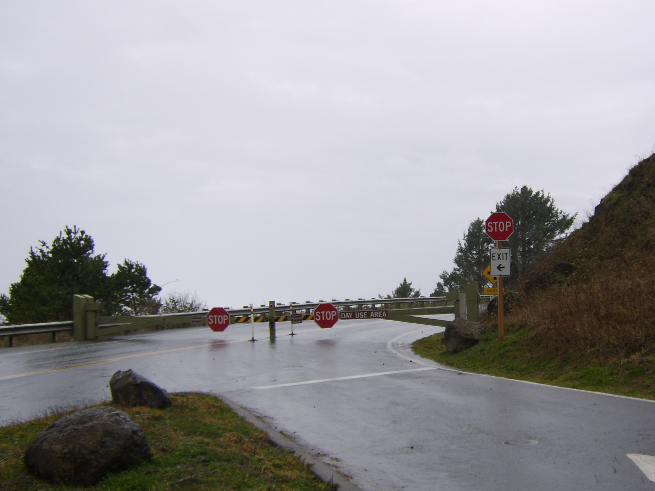


HIGH SURF WARNING NOW IN EFFECT
UNTIL 4 AM PST MONDAY FOR THE SOUTH WASHINGTON AND NORTH AND CENTRAL OREGON COAST
Urgent - Immediate Broadcast Requested Coastal Hazard Message...Corrected National Weather Service Portland OR 214 PM PST Sun Dec 2 2007
North Oregon Coast-Central Oregon Coast-South Washington Coast- 214 PM PST Sun Dec 2 2007
...High Surf Warning Now In Effect Until 4 AM PST Monday For The South Washington And North And Central Oregon Coast... ...Coastal Flood Warning In Effect From 4 AM To 12 PM PST Monday For The South Washington And North And Central Oregon Coast...
The National Weather Service In Portland Has Issued A Coastal Flood Warning...Which Is In Effect From 4 AM To 12 PM PST Monday. The High Surf Warning Is Now In Effect Until 4 AM PST Monday. The Coastal Flood Watch Is No Longer In Effect.
The Strongest Portion Of This Pacific Storm Will Affect The Coast Tonight And Monday Morning. With Stronger Winds The Seas Will Build To Over 40 Feet As Measured By Offshore Buoys By Late Tonight.
The Seas Combined With High Tides Monday Morning And The Strong Winds Will Be Able To Push The Ocean Into The Land. This Will Produce Flooding Due To The Ocean Water Being Past The Beaches And Damage Caused By Debris That Is Pushed Ashore By The Ocean. The Time Of Most Of The Coastal Flooding Will Be Around The Time Of High Tide.
The High Tide On The South Washington Coast At Toke Point Will Be 825 AM Monday Morning.
The High Tide On The North Oregon Coast At Astoria Will Be Around 842 AM Monday Morning.
The High Tide On The Central Oregon Coast Near Newport Will Be Around 800 AM Monday Morning.
Until Early Monday Morning The High Surf Warning Will Continue Along The Coast. A High Surf Warning Indicates That Dangerous... Battering Wave Will Pound The Shoreline. Seas Of This Magnitude Are Capable Of Rolling And Moving Large Logs. These Conditions Will Make Beaches...Jetties...And Breakwaters Unsafe. Beach Erosion Is Also Likely.
A Coastal Flood Warning Means That Flooding Is Occurring Or Imminent. Coastal Residents In The Warned Area Should Be Alert For Rising Water...And Take Appropriate Action To Protect Life And Property.
UNTIL 4 AM PST MONDAY FOR THE SOUTH WASHINGTON AND NORTH AND CENTRAL OREGON COAST
Urgent - Immediate Broadcast Requested Coastal Hazard Message...Corrected National Weather Service Portland OR 214 PM PST Sun Dec 2 2007
North Oregon Coast-Central Oregon Coast-South Washington Coast- 214 PM PST Sun Dec 2 2007
...High Surf Warning Now In Effect Until 4 AM PST Monday For The South Washington And North And Central Oregon Coast... ...Coastal Flood Warning In Effect From 4 AM To 12 PM PST Monday For The South Washington And North And Central Oregon Coast...
The National Weather Service In Portland Has Issued A Coastal Flood Warning...Which Is In Effect From 4 AM To 12 PM PST Monday. The High Surf Warning Is Now In Effect Until 4 AM PST Monday. The Coastal Flood Watch Is No Longer In Effect.
The Strongest Portion Of This Pacific Storm Will Affect The Coast Tonight And Monday Morning. With Stronger Winds The Seas Will Build To Over 40 Feet As Measured By Offshore Buoys By Late Tonight.
The Seas Combined With High Tides Monday Morning And The Strong Winds Will Be Able To Push The Ocean Into The Land. This Will Produce Flooding Due To The Ocean Water Being Past The Beaches And Damage Caused By Debris That Is Pushed Ashore By The Ocean. The Time Of Most Of The Coastal Flooding Will Be Around The Time Of High Tide.
The High Tide On The South Washington Coast At Toke Point Will Be 825 AM Monday Morning.
The High Tide On The North Oregon Coast At Astoria Will Be Around 842 AM Monday Morning.
The High Tide On The Central Oregon Coast Near Newport Will Be Around 800 AM Monday Morning.
Until Early Monday Morning The High Surf Warning Will Continue Along The Coast. A High Surf Warning Indicates That Dangerous... Battering Wave Will Pound The Shoreline. Seas Of This Magnitude Are Capable Of Rolling And Moving Large Logs. These Conditions Will Make Beaches...Jetties...And Breakwaters Unsafe. Beach Erosion Is Also Likely.
A Coastal Flood Warning Means That Flooding Is Occurring Or Imminent. Coastal Residents In The Warned Area Should Be Alert For Rising Water...And Take Appropriate Action To Protect Life And Property.
ORZ001-002-030130-
/O.CON.KPQR.HW.W.0008.000000T0000Z-071204T0600Z/
NORTH OR COAST-CNTL OR COAST-
INCLUDING THE CITIES OF.ASTORIA.CANNON BEACH.TILLAMOOK.
LINCOLN CITY.NEWPORT.FLORENCE
917 AM PST SUN DEC 2 2007
.HIGH WIND WARNING REMAINS IN EFFECT UNTIL 10 PM PST MONDAY
FOR THE NO. & CNTL OR COASTS.
A HIGH WIND WARNING REMAINS IN EFFECT UNTIL 10 PM PST MONDAY.
TWO PERIODS OF VERY STRONG WINDS ARE EXPECTED DURING THE NEXT
24 HRS ALONG THE NO. & CNTL OR COAST. THE FIRST WAS
BEGINNING THIS MORNING.WITH SO. WINDS OF 25 TO 35 MPH AND
GUSTS TO 75 MPH NEAR COASTAL HEADLANDS & BEACHES & 65 MPH IN
COASTAL COMMUNITIES TODAY. WINDS WILL DECREASE BRIEFLY THIS EVENING
BEFORE THE SECOND PERIOD OF EVEN STRONGER WINDS OCCURS LATE TONIGHT
AND MONDAY. BY MON MORNING WINDS WILL RISE TO 30 TO 50 MPH WITH
GUSTS TO POSSIBLY OVER 100 MPH NEAR THE HEADLANDS & BEACHES AND
80 MPH IN THE COASTAL COMMUNITIES. THE WINDS WILL DECREASE MONDAY
NIGHT ONCE THE ASSOCIATED COLD FRONT PUSHES ONSHORE.
THESE WINDS.ESPECIALLY THOSE LATE TONIGHT & MONDAY.ARE
STRONG ENOUGH TO PRODUCE SUBSTANTIAL DAMAGE & CAUSE POWER
OUTAGES.
A HIGH WIND WARNING MEANS A HAZARDOUS HIGH WIND EVENT IS EXPECTED
OR OCCURRING. SUSTAINED WIND SPEEDS OF AT LEAST 40 MPH OR GUSTS
OF 58 MPH OR MORE CAN LEAD TO PROPERTY DAMAGE.
/O.CON.KPQR.HW.W.0008.000000T0
NORTH OR COAST-CNTL OR COAST-
INCLUDING THE CITIES OF.ASTORIA.CANNON BEACH.TILLAMOOK.
LINCOLN CITY.NEWPORT.FLORENCE
917 AM PST SUN DEC 2 2007
.HIGH WIND WARNING REMAINS IN EFFECT UNTIL 10 PM PST MONDAY
FOR THE NO. & CNTL OR COASTS.
A HIGH WIND WARNING REMAINS IN EFFECT UNTIL 10 PM PST MONDAY.
TWO PERIODS OF VERY STRONG WINDS ARE EXPECTED DURING THE NEXT
24 HRS ALONG THE NO. & CNTL OR COAST. THE FIRST WAS
BEGINNING THIS MORNING.WITH SO. WINDS OF 25 TO 35 MPH AND
GUSTS TO 75 MPH NEAR COASTAL HEADLANDS & BEACHES & 65 MPH IN
COASTAL COMMUNITIES TODAY. WINDS WILL DECREASE BRIEFLY THIS EVENING
BEFORE THE SECOND PERIOD OF EVEN STRONGER WINDS OCCURS LATE TONIGHT
AND MONDAY. BY MON MORNING WINDS WILL RISE TO 30 TO 50 MPH WITH
GUSTS TO POSSIBLY OVER 100 MPH NEAR THE HEADLANDS & BEACHES AND
80 MPH IN THE COASTAL COMMUNITIES. THE WINDS WILL DECREASE MONDAY
NIGHT ONCE THE ASSOCIATED COLD FRONT PUSHES ONSHORE.
THESE WINDS.ESPECIALLY THOSE LATE TONIGHT & MONDAY.ARE
STRONG ENOUGH TO PRODUCE SUBSTANTIAL DAMAGE & CAUSE POWER
OUTAGES.
A HIGH WIND WARNING MEANS A HAZARDOUS HIGH WIND EVENT IS EXPECTED
OR OCCURRING. SUSTAINED WIND SPEEDS OF AT LEAST 40 MPH OR GUSTS
OF 58 MPH OR MORE CAN LEAD TO PROPERTY DAMAGE.
Saturday, December 01, 2007


| |
| HIGH SURF ADVISORY IN EFFECT FROM 6 AM TO 10 PM PST SUNDAY FOR THE CENTRAL OREGON COAST, COASTAL FLOOD WATCH IN EFFECT FROM SUNDAY EVENING THROUGH MONDAY AFTERNOON FOR THE CENTRAL OREGON COAST | |
| Issue Time: 2:08 PM PST Saturday Dec 1 2007 | |
| Valid Until: 4:15 AM PST Sunday Dec 2 2007 | |
| HIGH SURF ADVISORY IN EFFECT FROM 6 AM TO 10 PM PST SUNDAY FOR THE CENTRAL OREGON COAST UNTIL 4:15AM PST Urgent - Immediate Broadcast Requested Coastal Hazard Message National Weather Service Portland OR 208 PM PST Sat Dec 1 2007 Central Oregon Coast- 208 PM PST Sat Dec 1 2007 ...High Surf Advisory In Effect From 6 AM To 10 PM PST Sunday For The Central Oregon Coast... ...Coastal Flood Watch In Effect From Sunday Evening Through Monday Afternoon For The Central Oregon Coast... The National Weather Service In Portland Has Issued A High Surf Advisory...Which Is In Effect From 6 AM To 10 PM PST Sunday. A Coastal Flood Watch Has Also Been Issued. This Coastal Flood Watch Is In Effect From Sunday Evening Through Monday Afternoon. The Initial Portion Of A Very Strong Pacific Storm Will Move Into The Central Coast On Sunday. Seas As Measured By Buoys Just Offshore Will Top 20 Feet After Daybreak On Sunday And Rise To Around 25 Feet By Midday. Seas May Drop Off A Few Feet Late Sunday Afternoon And Early Evening Before Seas Build Again With The Stronger Portion Of This Storm. Seas Will Build To Near 40 Feet Early Monday Morning And May Top 45 Feet By Later Morning. These Seas Combined With Very Strong Winds And High Tides Have The Potential To Push The Ocean Into The Land Causing Damage And Flooding. High Tide On Monday Morning Will Be 745 AM Along The Central Oregon Coast. A High Surf Advisory Means That High Surf Will Affect Beaches In The Advisory Area...Producing Localized Beach Erosion. Seas Of This Magnitude Are Capable Of Rolling And Moving Large Logs In The Beach Area. Persons Near The Beaches Need To Use Caution Near These Logs Or Beach Debris. A Coastal Flood Watch Means That Conditions Favorable For Flooding Are Expected To Develop. Coastal Residents Should Be Alert For Later Statements Or Warnings...And Take Action To Protect Property. |
NewsGator Online
NewsGator Online: " 'My Grandmother is over eighty and still doesn't need glasses. Drinks right out of the bottle.'"
Friday, November 30, 2007


High Winds Forecast in County
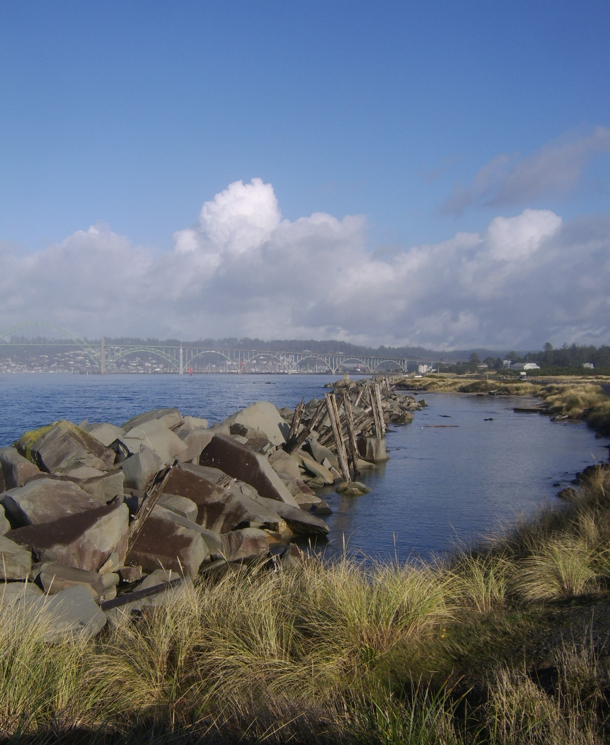
LCSD has taken part in a briefing with Lincoln County Emergency Services regarding strong damaging winds that are probable along the coast and in the Coast Range Sunday and Monday, December 2 and 3, 2007. Winds on Sunday have a potential of 50 mph with gusts to 70. On Monday, 65 mph sustained winds are predicted, with gusts to 100.
If it is determined that schools and buses will operate as usual on Monday, no statement will be issued from the District. If buses and schools are impacted, information will be provided in the following ways:
►By 6:00 a.m. local radio stations and major Portland TV news stations will be
notified and will begin making announcements.
►A message will be recorded on the LCSD 24-hour information line: 265-4437.
►By 6:30 a.m., the LCSD website www.lincoln.k12.or.us will be updated with the
current school closure/delay information.
►If local radio stations are off the air, please tune your radio to channel a.m. 1110
out of Bend.
Power outages and/or downed power lines may make Internet access and phone messaging systems unavailable. Because of isolated inclement weather situations, some areas might close or have a two-hour delay, while other unaffected areas will remain open.
From Dan Wilson in an email.... on The storm
Hi folks:
I just returned from a National Weather Service briefing at the court house. I Want to make sure you all have as much info as possible. Ron, will you pass along on the web and other sources you have. This is a summary of this weekend's forecasted activities:
Winds: Southerly, starting Saturday and becoming stronger until they attain sustained winds of 50 mph w/gusts on 70 Sunday afternoon. By Sunday midnight and into Monday morning winds will increase to 60-65` mpg and gusts 80-100 mph.
Rain: Sunday and Monday rain accumulations on the coast should be about 2-3 inches. No river flooding is anticipated along the coast, even with heavy snow in the mountains.
Snow: Expect 1" on the valley floor, 2-4 inches in the gorge, 2-3" in the coast range and 12-18" in the cascades. Travel over the mountains will be bad, to say the least
Surf: Expect 36-40 ft surf. The beaches will be extremely dangerous.
Temperatures: Temps will remain in the 40's locally
Emergency information: KYTE, 102.7, is the official emergency radio station. If power is out and KYTE can no longer transmit, Bend station 111.0 can be received here and will broadcast information about the coast.
Let's hope this storm is not as wicked as predicted, but you should all have your emergency kits handy (water, light, foods, etc) if or when the power goes out.
Spread the word and be careful out there.
Dan
An Email from Milt about the PUD house heating check....
As near as we know, 4 homes in L V H have now been tested. Two of the four tested O K. Two others required a bit of help. The owners of all four were impressed. We can personally recommend the testing. It saved us a trip under the house. And so far as we have heard, there is no charge unless the cross over duct has to be replaced. Sounds too good to be true?? Well, if any unpleasant sounds reach us, we'll let you know. Meanwhile, this may be the first time that something which sounded too good, actually turned out to be true. The test crew which came here was the epitome of efficiency---they came, tested, and were gone in 25 minutes. If work needs to be done, their stay could be 2 hours. Better think about it. Milt
As near as we know, 4 homes in L V H have now been tested. Two of the four tested O K. Two others required a bit of help. The owners of all four were impressed. We can personally recommend the testing. It saved us a trip under the house. And so far as we have heard, there is no charge unless the cross over duct has to be replaced. Sounds too good to be true?? Well, if any unpleasant sounds reach us, we'll let you know. Meanwhile, this may be the first time that something which sounded too good, actually turned out to be true. The test crew which came here was the epitome of efficiency---they came, tested, and were gone in 25 minutes. If work needs to be done, their stay could be 2 hours. Better think about it. Milt
Monster storm heading our way
A system to arrive Sunday may prompt Oregon's first hurricane wind warning
Friday, November 30, 2007
STUART TOMLINSON
The Oregonian To the extent forecasting the weather is like playing music, Oregon meteorologists Thursday were cranking up the volume.
Forecasters from the public and private sector, as well as the media, were scrambling to get their arms around a double-whammy of winter weather barreling toward the region. They expect a rare Willamette Valley snowstorm Saturday, followed by what some predict will be a once-a-decade storm packing high winds and heavy rains early next week.
The National Weather Service has said it might issue its first hurricane wind warning for Oregon in advance of the second storm.
"Everything points to this being a very strong, prolonged event," said the weather service's Ira Kosovitz. "We could see sustained winds of 90 miles per hour, if not 100."
The ingredients for snow Saturday at the lower elevations in northwest Oregon and southwest Washington are coming together, with the highest likelihood of accumulations in the area from Salem in the south to Olympia in the north.
"I think we'll see snow starting around 10 or 11 a.m. lasting for a couple of hours but with not a lot of accumulation," said Clinton Rockey of the National Weather Service in Portland. "It should change over to rain by midafternoon, but snow throughout the day in the Columbia River Gorge and the Cascades."
As noteworthy as that forecast is -- snow being rare around here -- the biggest news Thursday at the National Weather Service offices in Portland was the approaching "monster" Pacific storm that's going to bring potentially damaging winds and widespread flooding to the region Sunday into Monday and Tuesday.
The size and scope of the storm -- which has tapped into the energy of typhoons Mitag and Hagibis -- may prompt the first hurricane force wind warning, which would mean sustained winds of 74 mph or higher on the Oregon and Washington coasts.
That's a big deal, but not quite as big as the "first in history" designation might suggest.
Bill Schneider, the science and operations manager for the weather service, said the agency was given the go-ahead by the National Oceanic and Atmospheric Administration only five years ago, in 2002, to issue such a warning "to highlight the extreme nature of rare storms that may only occur once every 5 to 10 years."
Schneider said such storms -- extratropical cyclones -- don't have the structure of a hurricane, and shouldn't be confused with an actual hurricane, but they are, in fact, larger and have a broader impact zone.
After the wind comes the rain. George Taylor of the Oregon Climate Service characterized the looming storm as a "hybrid," with traits similar to the damaging windstorm of December 1995 and the flooding rains of November 1996.
Forecast models show a plume of moisture extending from Oregon to Hawaii by late Sunday, a classic Pineapple Express that's been called an atmospheric river.
"The intensity of the winds followed by intense rains makes it a very significant storm with big-time rain," Taylor said. "We could see three to four inches (of rain) in the valley, and even more at higher elevations."
The storm is expected to combine rising snow levels with heavy rains, a recipe responsible for damaging floods.
Snow levels -- which have been below pass level this week, allowing Timberline to go to full operations, and Mt. Hood Meadows, Mt. Bachelor and Mt. Hood Skibowl to open additional lifts -- will begin to rise Sunday.
Matt Zaffino, meteorologist for KGW (8) in Portland, said the storm's deep area of low pressure is one of the strongest he's seen in recent memory, even stronger than the Columbus Day Storm of October 1962. He predicted that this storm, however, won't be as damaging as that storm because it will stay farther offshore.
Even so, Zaffino said, "This thing is an absolute monster -- it covers the entire Northeast Gulf of Alaska.
"It's huge."
Stuart Tomlinson: 503-221-8313; stuarttomlinson@ news.oregonian.com
Thursday, November 29, 2007
 Wayne Hill Shares ThisWith US.......
Most of you know I am a huge Duck fan but that has nothing to do with this article. You need to click on and go to this article. Check out Brandon Hill who is the son of our own Wayne Hill. Way to go Brandon!!!!
Here is a news story on Channel 16 in Eugene and saw a like story in the
Eugene Register Guard and on Channel 12 in Portland. The story is of my son
Brandon Hill in Iraq. Just click the link below. This came from my
daughter Heather.
Wayne
----- Original Message -----
From: "KMTR Alerts" <alerts@kmtr.com>
To: <duck033@hotmail.com>
Sent: Thursday, November 29, 2007 8:57 AM
Subject: Heather has sent you a news story from NewsSource16
Heather saw "Soldiers divided on Oregon's Civil War" on NewsSource16 and
thought you'd be interested in it too.
Here's what they wrote to you about it:
Too cool!
Article Link:
http://www.kmtr.com/news/local
To see more stories please visit http://www.kmtr.com
Note: This email was sent to you by Heather and is not automated. This
station will not store or use your email address in any way.
NewsGator Online
NewsGator Online: "Jack Benny 11/27/2007 5:00:00 PM [rss@quotationspage.com (Quotes of the Day)] 'I don't deserve this award, but I have arthritis and I don't deserve that either.'"
NewsGator Online
NewsGator Online: "Will Rogers 11/27/2007 5:00:00 PM [rss@quotationspage.com (Quotes of the Day)] 'Live in such a way that you would not be ashamed to sell your parrot to the town gossip.'"
Wednesday, November 28, 2007
TRUFFLES TODAY
COME HELP MAKE TRUFFLES FOR THE DESSERT AT TRIM-A-TREE SATURDAY EVENING..JOIN US THURSDAY, NOVEMBER 29 AT 10AM IN THE KITCHEN AT THE CLUBHOUSE.. FUN & GOOEY!!!!!!!!

Tuesday, November 27, 2007
C.E.R.T. PHOTO OP.
C.E.R.T. TEAM members at the LVH clubhouse on Tuesday evening, November 27, 2007, modeling their new official C.E.R.T. jackets. In addition to the LVH C.E.R.T. team, there were also members from the greater Newport area in attendence. Even though this seems like alot of members, there were about 30 or so that were unable to make it for the photo op.
In an emergency or catastrophic event affecting our park or general vacinity, these are the people DEDICATED to helping us and others survive the event. If you see them around, SAY HELLO!
 at the LVH clubhouse on Tuesday evening, November 27, 2007, modeling their new official C.E.R.T. jackets. In addition to the LVH C.E.R.T. team, there were also members from the greater Newport area in attendence. Even though this seems like alot of members, there were about 30 or so that were unable to make it for the photo op.
 In an emergency or catastrophic event affecting our park or general vacinity, these are the people DEDICATED to helping us and others survive the event. If you see them around, SAY HELLO!

BBC NEWS | Science/Nature | Google's cheaper-than-coal target

BBC NEWS | Science/Nature | Google's cheaper-than-coal target: "'With talented technologists, great partners and significant investments, we hope to rapidly push forward,' said Larry Page, Google co-founder. 'Our goal is to produce one gigawatt of renewable energy capacity that is cheaper than coal. We are optimistic this can be done in years, not decades.' One gigawatt can power a city the size of San Francisco, one of California's biggest cities. Google is already backing fuel-efficient cars. Google.org is giving out grants to help commercialise plug-in hybrids and fully electric vehicles. The company itself has a 1.6-megawatt solar panel system installed at its headquarters in Mountain View, California. Google said it expected to focus its early efforts on solar thermal technology, and would be spending 'tens of millions' of dollars in 2008 on the RE < C initiative. In the future, however, this support should grow considerably."
Monday, November 26, 2007
NewsGator Online
NewsGator Online: "Dave Barry 11/25/2007 5:00:00 PM [rss@quotationspage.com (Quotes of the Day)] 'We Americans live in a nation where the medical-care system is second to none in the world, unless you count maybe 25 or 30 little scuzzball countries like Scotland that we could vaporize in seconds if we felt like it.'"
Confessions of a tow truck driver - CNN.com
Confessions of a tow truck driver - CNN.com: "Repossession and impound business Dan worked as a part-time driver for five years and gave us some insight into how the repossession business works. The first step is simply getting the address of the car. It doesn't matter how they find out where the person lives, they just need to have that address. Dan said that some finance companies give them an address, but if it's the wrong one, 'They might have someone call the guy and tell him something stupid like he's won tickets to something and they want to know where to send them -- anything sneaky so they get the guy's address,' he said. 'Some people are so dumb that that they give their address and their car is just sitting there.'"
At 97, ham radio operator still scanning the airwaves - News - TriCities.com

At 97, ham radio operator still scanning the airwaves - News - TriCities.com: "SPECIAL TO THE HERALD COURIER BRISTOL, Tenn. – At 97, Margaret Roberts is lucid and lively and the owner of a new pacemaker. “The doctor said they normally wouldn’t give a pacemaker to someone her age,” said her niece-in-law, Linda Bowers. “But he checked her out and said she was a good candidate.” Roberts has more than just her good health to surprise people. She has been a licensed amateur radio operator, a “ham,” since 1947 and still broadcasts today. "
Subscribe to:
Posts (Atom)